
Mu Ko Ang Thong National Park is a marine national park in Thailand known for its archipelago of 42 islands, towering limestone cliffs, white-sand beaches and clear waters in the Gulf of Thailand. Visitors can discover hidden lagoons, explore sea caves, snorkel, kayak and climb to viewpoints overlooking the tropical islands.
Location
The archipelago lies in the Gulf of Thailand, about 30 kilometres west of Koh Samui, off the coast of Surat Thani Province. The name Mu Ko Ang Thong is often translated as the “archipelago of the golden bowl.” Its landscape is characterised by steep limestone hills covered in tropical vegetation, with small bays and lagoons between the islands.
The national park was established in 1980 and covers about 102 square kilometres, most of which is marine area. There are no major towns or large resorts on the islands, so most visitors arrive on day trips from Koh Samui or nearby islands.
Thale Nai Emerald Lagoon
One of the archipelago’s best-known sights is Thale Nai, also called the Emerald Lake. Located on Ko Mae Ko, this saltwater lagoon is surrounded by tall limestone cliffs and dense tropical vegetation. Its vivid colour is particularly striking from the viewpoints above the lagoon.
A walking route with steps leads to an overlook. The climb requires some effort, so comfortable shoes and drinking water are recommended. From the viewpoint, visitors can admire the lagoon and surrounding cliffs. Stay on marked paths and follow park rules to protect the environment.
Ko Wua Ta Lap Island
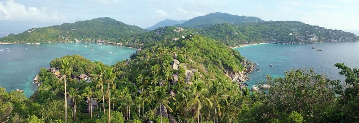
Ko Wua Ta Lap is one of the main islands visited by tourists. It has park facilities, a beach and the well-known Pha Chan Charat viewpoint. From the top, visitors can enjoy a panoramic view of dozens of forested islands rising from the blue sea.
The viewpoint is reached by a steep forest trail. Ropes are available on some sections to help with balance. The climb can be tiring in hot weather, so take your time, wear suitable footwear and bring enough water. A sandy beach at the foot of the hills offers a place to relax after the walk.
Islands, beaches and limestone cliffs
The park’s defining feature is its unusual limestone landscape. High cliffs rise directly from the sea, creating narrow channels, small bays and secluded stretches of coast. Some islands have sheer rock faces, while others are fringed with light sandy beaches.
Boat trips offer different views of the islands and may include stops at selected beaches. Landing is not possible everywhere. Follow the crew’s instructions and keep away from exposed rocks when the sea is rough.
Snorkelling and marine life
The park’s waters support a variety of marine organisms. Coral communities and tropical fish can be found in some areas, making snorkelling a popular activity. Underwater visibility depends on the season and sea conditions, and not every area is equally suitable for swimming with a mask.
To protect marine ecosystems, do not stand on coral, touch marine animals or collect natural objects. Follow the advice of your tour operator before entering the water.
Kayaking and boat excursions
Kayaking is an enjoyable way to explore parts of the coastline. Paddlers can travel along limestone walls, enter sheltered bays and see the cliffs from water level. Most visitors explore the park on a day trip by speedboat or larger tour boat.
Tour itineraries vary. Some include snorkelling and kayaking, while others focus on viewpoints, beaches and Thale Nai. Before booking, check the trip duration, included activities and availability of equipment.
Vegetation and wildlife
The islands are covered with tropical forest, while coastal areas support specialised shoreline vegetation. Natural habitats remain for birds, reptiles and small mammals. Marine ecosystems contain a variety of fish and invertebrates.
Visitors should take all rubbish away, avoid feeding wildlife, leave plants undisturbed and never remove coral or shells. Responsible behaviour helps preserve the archipelago’s natural environment.
Best time to visit
Conditions for boat trips depend on the season and the state of the sea. Calm weather generally makes the journey more comfortable and water activities easier to enjoy. During the rainy season, rough seas can lead to cancellations or temporary access restrictions.
The national park closes to visitors for part of the year, usually from 1 November to 15 December. Exact dates can change, so check current notices from the park authorities and your tour operator before travelling.
How to get there
The most common way to visit Mu Ko Ang Thong is on a boat excursion from Koh Samui. Some tours also depart from Koh Phangan. The journey is made by speedboat or tour vessel, and travel time depends on the boat, weather and itinerary.
Travel tips
Bring lightweight clothing, swimwear, suitable shoes for hiking, a hat, sun protection and drinking water. A waterproof bag is useful for valuables. Check the weather forecast, follow your guide’s instructions and stay on marked trails.
Mu Ko Ang Thong National Park combines tropical islands, limestone cliffs, hidden lagoons and rich marine ecosystems. The panorama from Ko Wua Ta Lap, the Emerald Lagoon and kayaking routes make it one of Thailand’s most memorable natural destinations.
Gallery