Philae
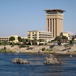
Philae Island, which is located in the middle of the Nile River in Egypt, is a historical find of scientists. Even before its flooding, it occupied an area of 380 m long, and its width was set at 120 m. In ancient times, this territory was known as the islands at the river's threshold and was called Pilak (translated as angular). Now this historically significant site is protected by UNESCO as a World Heritage Site.

Believing in ancient Egyptian beliefs, Osiris himself is buried here. In ancient times, this island was considered an inviolable land. Only the priests had the right to be on this sacred land. Even the fish and birds were wary of him. There was a time when this island served as a trading point for the Pharaohs with Nubia. During the reign of the Ptolemaic dynasty, buildings grew very quickly on these lands, the materials for which were granite from adjacent quarries. Some of these structures have been preserved to our time.
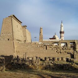
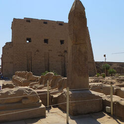
Temple complexes were built here, which included the temple of Nectanebus I, the monumental temple of Isis with adjoining buildings, the elegant pavilion of Trajan and the very small temple of Hathor.

The temple erected by Nectaben I was supported by both the Egyptian rulers themselves and the Ptolemies. It was then that two huge obelisks were erected here, various sculptures appeared, including sitting lions from granite, and stone cages for sacred pigeons were built. The walls of the temple, as befits ancient Egyptian culture, were painted with various drawings, as well as amazing reliefs that certainly tell about the life of Osiris. This temple existed as one of the last pagan sanctuaries in the Byzantine lands. Under Justinian, it was transformed into the church of the Virgin, and all evidence of her adventures was destroyed. This is how the reliefs and drawings on the walls were brought out by the iconoclasts.
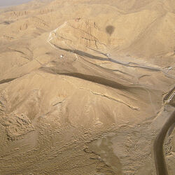
In the twentieth century, scientists faced the question of moving this memorable ensemble of buildings to the island of Aguilica. The reason for this decision was the threat of the temple sinking under the water of the Nile. UNESCO was the initiator of such an important event. After careful measurement, photographing, and transportation of these World Heritage stone blocks, the temple structures were successfully installed in an area 500 meters upstream, where they are not in danger of flooding.
Philae Island is now open to the public. Twice a day, tourists are invited to visit a memorable light and music show, during which the history of the temple ensemble is presented, which was built here by notable people in its time.