Fort Bourtange
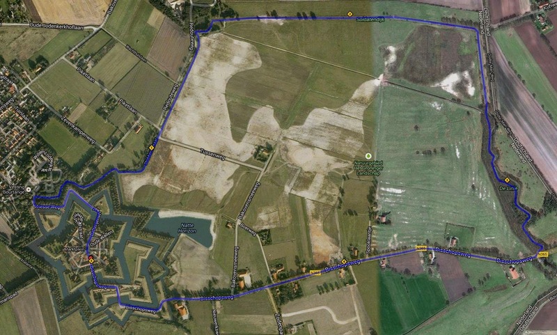
In the Dutch village of Burtange there is an amazing fort of the same name, built in the shape of a star. It was built to control the road between Germany and the town of Groningen during the Dutch Bourgeois Revolution.
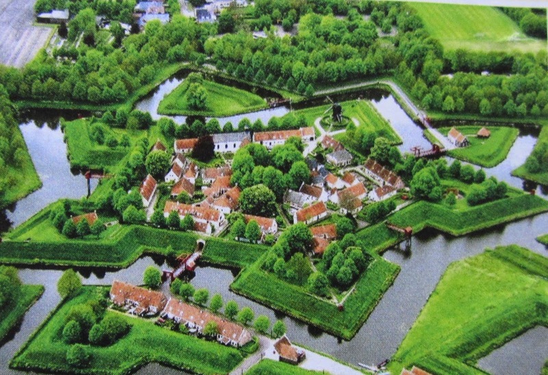
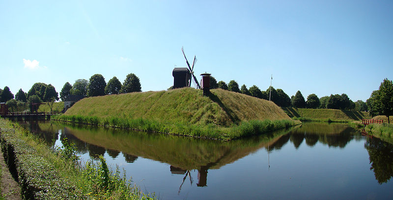
During the Eighty Years' War (Dutch Revolution) (1568-1648), the Spanish in Groningen controlled the roads from the city to Germany. William I of Orange, the leader of the Netherlands, realized that it was necessary to break the link between Groningen and Germany. In his opinion, it would be optimal to build a fortified fortress on the road leading to Germany. The fort was built in 1593 in the shape of a star with a network of channels, ditches (which were also dug in the form of stars). Such fortresses became popular in the 16th century, replacing castles whose high walls were easily demolished by cannons. At the time of completion, the fortress of Bourtange already housed a garrison, which had to face the Spanish troops from Groningen. The walls of the fortress stood the test of strength, and the Spaniards had to retreat.
In 1607, the walls of the fort were reinforced, and after the end of the revolution in 1648, the Burtange was abandoned. But soon from France. The threat to England and its allies began to grow, then in 1665 troops re-entered the fortress to defend the Westerwolde area from the Bishopric of Munster, which fought on the side of England during the Second Anglo-Dutch War (1665-1667). In 1672, Christoph-Bernhard von Galen, the German Prince-Bishop of Munster, joined France (the Dutch War of 1672-1678) and captured 18 cities and towns in north Holland. Approaching Burtange, he demanded his surrender, but the governor of the fortress, Captain Protts, refused him. Then Galen sent his troops into a frontal attack, but stuck in swamps and ditches, shot from the walls of Bourtange, they could not resist the defenders of the fortress. The siege soon had to be stopped.
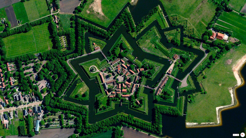
Having survived the last battle in 1672, the fort continued to serve in the defensive network on the border with Germany, until it was finally abandoned in 1851. Burtange was transformed into a village and the condition of the fortress began to deteriorate. It was only in 1960 that the local authorities restored the fortress and turned it into a museum of local lore, which brings substantial income to the villagers through tourism. Today, the village has about four hundred inhabitants, and international festivals for the reconstruction of historical battles are held.


