
Doi Inthanon is Thailand’s highest mountain and the main attraction of the national park of the same name in Chiang Mai Province in northern Thailand. Its summit reaches 2,565 metres above sea level. The national park was established on 2 October 1972 to protect mountain forests, waterways, and wildlife. It covers approximately 482.4 km², or 48,240 hectares.
Thailand’s highest mountain
Doi Inthanon belongs to the Thanon Thong Chai mountain range. In the past, it was known as Doi Luang and Doi Ang Ka. Its present name honours Inthawichayanon, one of the last rulers of Chiang Mai, who was concerned about protecting northern Thailand’s forests. The mountain’s elevation gives it a cooler climate than the surrounding lowlands.
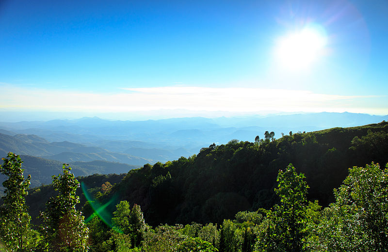
A paved road reaches close to the highest point, so visitors do not need to undertake a long mountain climb. A short walking path leads from the parking area to the marked summit. For wider views, visitors can use viewpoints along the road leading to the peak.
Mountain forests and biodiversity
The national park stretches from foothills to the mountain summit. This wide range of elevations creates several habitats: seasonally dry and mixed forests occur at lower levels, while pine and evergreen montane forests grow higher up. Moist cloud forests develop near the summit, where mosses, ferns, and epiphytes are abundant.
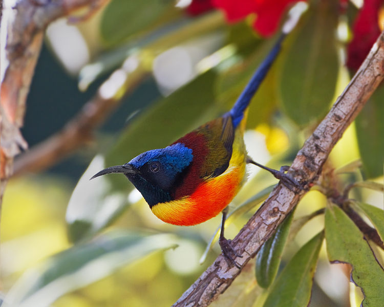
Doi Inthanon is particularly popular with birdwatchers. Numerous species have been recorded in the park, including birds associated with montane forests. Mammals, amphibians, reptiles, and insects also inhabit the area. Visitors can help protect this biodiversity by staying on permitted trails and avoiding disturbance to wildlife.
Waterfalls of Doi Inthanon
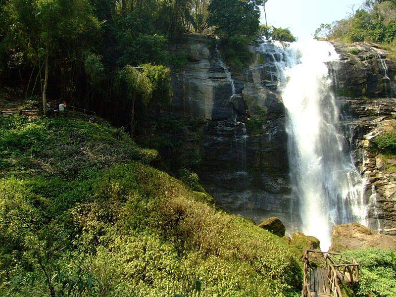
Waterfalls are among the park’s most impressive natural attractions. Wachirathan Waterfall plunges over a high rocky ledge and is especially powerful during the rainy season. On sunny days, rainbows sometimes appear in the spray. Its location near the road makes it an accessible stop for visitors.
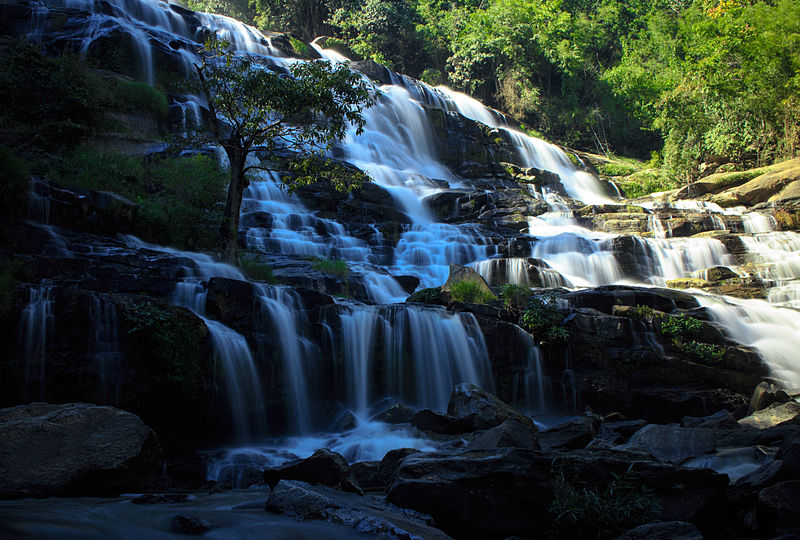
Mae Ya Waterfall is known for its broad cascade flowing down several tiers of rock amid dense vegetation. Other popular waterfalls include Mae Klang, Sirithan, and Siriphum. Water levels change with the seasons, so the appearance of the falls can differ considerably between the dry and rainy periods.
Nature trails and a sea of mist
Kew Mae Pan is a well-known mountain trail offering views of ridges, valleys, and clouds drifting above the forests. Some of the most memorable panoramas appear early in the morning during the cooler season. Access depends on park regulations and seasonal restrictions; certain routes require a local guide.
The Ang Ka trail passes through a moist high-altitude forest near the summit. Raised walkways cross moss-covered vegetation and wet ground while reducing damage to the fragile habitat. The short route offers a glimpse of a cool mountain ecosystem unusual in tropical Thailand.
The Royal Pagodas
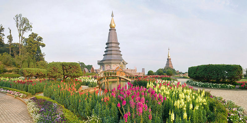
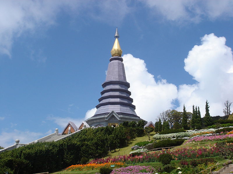
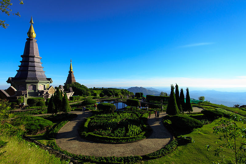
Near the summit stand two prominent pagodas: Phra Mahathat Naphamethanidon and Phra Mahathat Naphaphonphumisiri. They were built in honour of King Bhumibol Adulyadej and Queen Sirikit. The complex includes landscaped gardens, flowers, paths, and viewpoints. Views extend over the surrounding mountain slopes and valleys, although clouds may obscure distant scenery.
When to visit
The park can be visited throughout the year, but conditions vary by season. The cooler period, usually from November to February, is comfortable for walking, and a sea of mist often forms in the morning. During the rainy season, the forests become especially lush and the waterfalls more powerful, although trails can be slippery. Even in warmer months, temperatures near the summit can be low, so a light jacket is useful.
Doi Inthanon lies approximately 70–100 kilometres southwest of Chiang Mai city, depending on the route. A full day is convenient for visiting the main attractions. Before travelling, check current opening hours, trail conditions, and restrictions on particular areas.
Gallery