
Chapada Diamantina National Park is one of Brazil’s most impressive natural areas. Located in the central part of Bahia State in northeastern Brazil, it is known for mountain ranges, deep valleys, waterfalls, caves, and clear rivers. Rocky plateaus, green gorges, and unusual mountain formations create a remarkable variety of scenery within a relatively compact region.
The national park was established in 1985 and covers approximately 152,000 hectares. It protects part of the Serra do Sincorá mountain range, which belongs to the broader Serra do Espinhaço system. The region has exceptional ecological diversity, with elements of the Atlantic Forest, Cerrado, and Caatinga occurring side by side. This makes Chapada Diamantina one of Brazil’s leading destinations for ecotourism and outdoor adventure.
Mountains and geological features
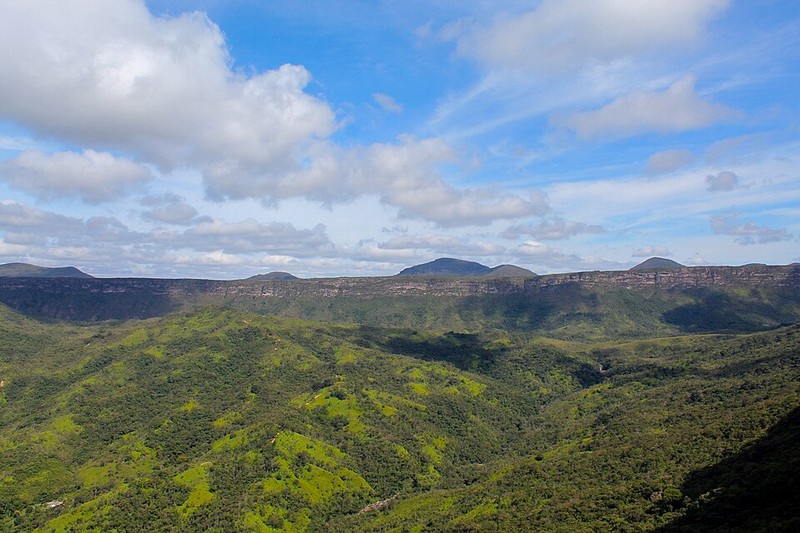
The landscape of Chapada Diamantina was shaped by long geological processes. Sandstone and other sedimentary rocks were gradually affected by water, wind, and temperature changes, forming cliffs, plateaus, canyons, and deep valleys. In some areas, mountain peaks rise above the surrounding plains, offering expansive panoramic views.
The region’s name is connected to its history of diamond mining. During the nineteenth century, local settlements developed around the search for precious stones, and old mining roads and historic towns still recall that period. Today, the area’s main value lies in its natural landscapes, diverse ecosystems, and opportunities for hiking.
Fumaça Waterfall
One of the park’s best-known attractions is Cachoeira da Fumaça, or Fumaça Waterfall. It is about 390 metres high, making it one of Brazil’s tallest waterfalls. Water plunges from a sheer cliff into a deep valley, and strong winds can disperse the falling stream into fine droplets, creating the appearance of mist or smoke. This phenomenon is associated with the waterfall’s name, which means “Smoke”.
Hiking routes of different difficulty levels lead to the waterfall. The upper viewpoint offers views of the rocky walls and valley, while longer treks allow visitors to approach the lower section. Before choosing a route, consider your fitness level, weather conditions, and the advice of local guides.
Morro do Pai Inácio
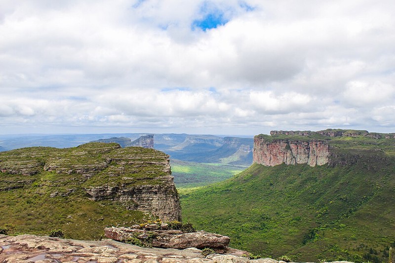
Morro do Pai Inácio is one of the region’s most recognizable peaks. It rises above the surrounding plateau and is famous for panoramic views of valleys, rocky formations, and the vast landscapes of Chapada Diamantina. The climb is relatively short compared with multi-day trekking routes, although the final section can be steep and rocky.
Visiting near sunset is especially popular. Evening light colours the rocks in golden and reddish shades, while shadows emphasize the shape of the plateau. It is one of the region’s best locations for panoramic photography and appreciating the scale of the landscape.
Caves and underground rivers
Chapada Diamantina is known not only for its mountains and waterfalls but also for its many caves. Underground spaces developed over long periods as water widened cracks and formed chambers, tunnels, and unusual rock formations. Some caves contain stalactites, stalagmites, and underground pools.
Popular sites include Pratinha, Torrinha, and Lapão caves. In some grottoes, the water is so clear that the bottom and underwater rock formations can be seen. Visiting certain caves requires a local guide, and access to some areas may be restricted to protect visitors and preserve the natural environment.
Rivers and natural pools
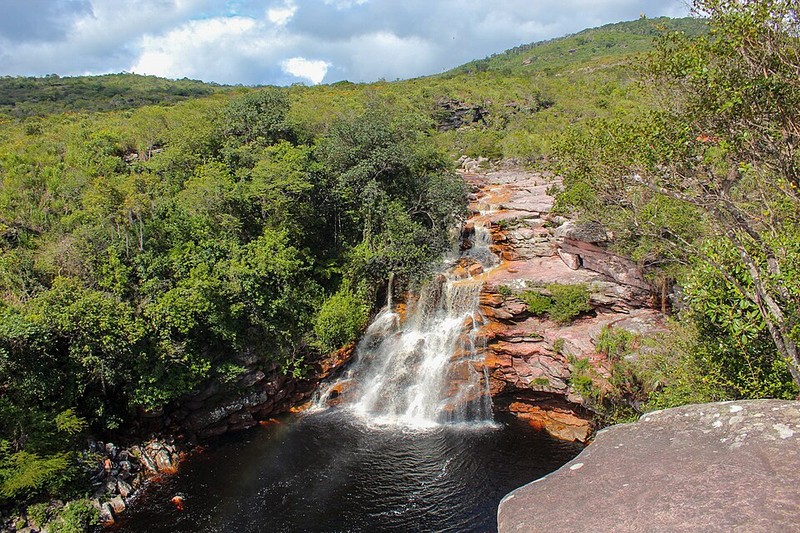
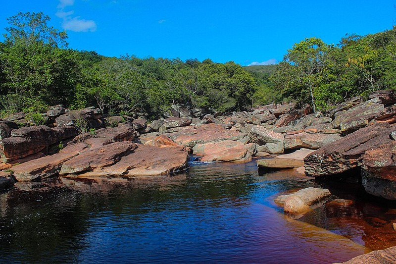
The region contains numerous rivers and streams that form small waterfalls, natural pools, and cascades. One well-known place to relax is the Mucugezinho River, with its rapids and natural rock basins. In designated locations, visitors can swim, rest beside the water, and observe the surrounding vegetation.
The Marimbus area is also noteworthy. This wetland landscape contains rivers, lagoons, and aquatic vegetation and is sometimes called the local Pantanal because of its character. Visitors can enjoy a peaceful water excursion and discover another aspect of Chapada Diamantina’s natural diversity.
Flora and fauna
The park contains several types of natural communities. Open plateaus support low shrubs, grasses, and plants adapted to poor soils and seasonal water shortages. Forest patches remain in wetter valleys, while denser vegetation grows along rivers. These varied conditions support many species of birds, reptiles, mammals, and insects.
Some plant and animal species have restricted ranges and depend particularly on the preservation of their habitats. The national park plays an important role in protecting these ecosystems and maintaining ecological connections between mountain forests, open plateaus, and river valleys. Visitors should stay on permitted trails, avoid collecting plants, and take all rubbish away.
Lençóis and the region’s historic heritage
Lençóis is one of the region’s main tourist centres and a convenient base for exploring Chapada Diamantina. The town expanded during the nineteenth-century diamond rush, and historic buildings, old streets, and architecture connected with the mining past remain. Today, Lençóis has hotels, guesthouses, restaurants, and tour agencies.
Besides Lençóis, travellers often use Mucugê, Palmeiras, and Andaraí as bases. The best choice depends on the location of the attractions and the length of the trip. Since natural sites are spread across a large area, several days are recommended for a fuller exploration of the region.
Best time to visit
Chapada Diamantina can be visited throughout the year, although conditions vary by season. During rainy months, waterfalls and rivers are usually fuller, but heavy rainfall can make hikes more difficult and raise water levels. In drier periods, trails may be more convenient for walking, although some waterfalls become less powerful.
Before travelling, check local weather conditions, trail status, and access to specific attractions. Longer hikes should be planned in advance, and hiring a local guide may be advisable. Visitor facilities are not available on every trail within the park, so bring water, suitable footwear, and the navigation equipment you need.
Getting there and practical considerations
Lençóis and other towns in Bahia serve as main starting points for trips to the region. From Salvador, the state capital, travellers can reach the area by bus, car, or by flying to Lençóis Airport when suitable flights are available. Local transport is usually needed to reach individual natural attractions, and some routes begin near smaller settlements.
The attractions are spread over considerable distances, and public transport between some areas can be limited. Before travelling, decide which waterfalls, caves, and mountain trails interest you most and plan the logistics in advance. For challenging trails, cave visits, and long treks, it is best to use experienced local guides.
Chapada Diamantina National Park combines dramatic mountains, high waterfalls, clear rivers, underground caves, and a rich regional history. It is suitable both for short walks to scenic viewpoints and for multi-day treks through valleys and mountain trails. Its varied landscapes make it one of Brazil’s most rewarding natural destinations.
Gallery