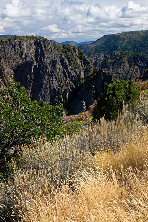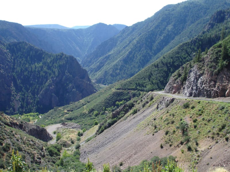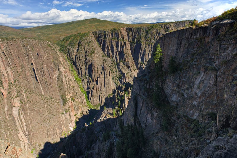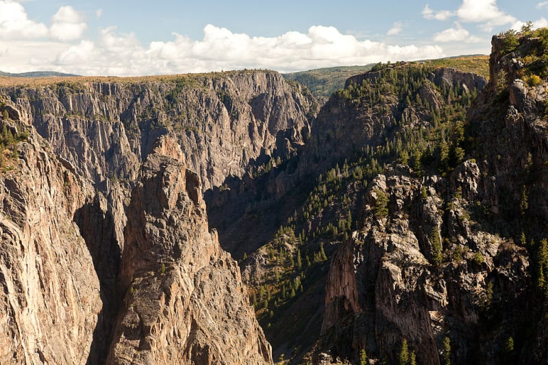

Black Canyon of the Gunnison National Park is located in western Colorado, United States, in the western part of the Rocky Mountains. It is famous for its deep gorge, the Gunnison River, nearly vertical dark cliffs, narrow rock spires, and dramatic changes in elevation.
The area became a national monument in 1933 and was designated a national park in 1999. Over a long geological period, the Gunnison River cut through ancient rock, creating steep walls, sharp formations, and narrow passages. The canyon's name reflects its dark walls and the limited sunlight that reaches the bottom.
Depth and Geology
At its deepest points, the canyon descends roughly 800 meters below the surrounding plateau. Its walls consist largely of ancient igneous and metamorphic rocks. Pale mineral veins stand out against the dark stone, creating striking patterns.
Water, weathering, and other geological processes shaped the canyon over millions of years. Its narrow floor and steep slopes make it one of Colorado's most remarkable natural landscapes.
Painted Wall
Painted Wall is one of the park's best-known landmarks. This impressive cliff reaches approximately 685 meters in height, making it the tallest cliff in Colorado. Light-colored mineral bands cross the dark rock where igneous material intruded into older formations.
Painted Wall is best viewed from designated overlooks. The contrast between dark stone, pale mineral lines, and vegetation along the canyon rim creates one of the park's most recognizable views.
The Gunnison River
The Gunnison River flows along the canyon floor and continues to shape the landscape. Its waters pass between steep rock walls, and the current is swift in some sections. The river is an important part of the local ecosystem and supports fish, aquatic invertebrates, and birds.
The easiest way to see the river is from overlooks along the rim. Reaching the water is possible only by specific routes and requires serious preparation. Steep slopes, loose rocks, and strong currents make an unplanned descent dangerous.
The South Rim
The South Rim is the park's most visited and developed area. It has a visitor center, paved roads, parking areas, and numerous overlooks. Well-known viewpoints include Gunnison Point, Pulpit Rock Overlook, Chasm View, and Painted Wall View.
South Rim Drive allows visitors to stop at different viewpoints and see the canyon from several angles. Many overlooks are close to parking areas, so visitors can enjoy the scenery without long hikes. However, not every edge has a guardrail, and visitors should stay well back from drop-offs.
The North Rim
The North Rim is quieter and less developed. It has fewer visitors, and parts of the access road are unpaved. Highlights include Chasm View, North Vista Trail, and overlooks facing Painted Wall.
Facilities are limited, so check road conditions and campground availability before traveling. The North Rim road closes to vehicles in winter, usually from mid-November until early May.
Scenic Overlooks and Hiking Trails
One of the easiest ways to explore the park is to drive along South Rim Drive and stop at the overlooks. Rim Rock Trail and Oak Flat Loop Trail offer walks through wooded areas with views of the canyon. On the North Rim, North Vista Trail is a popular option.
Check current trail conditions before setting out, as some routes may close temporarily. A few hours or a full day is enough for a general visit, while longer hikes require more time and planning.
Rock Climbing and River Access
The canyon's near-vertical walls, narrow cracks, and isolated rock formations attract experienced climbers. Many routes require specialized equipment, advanced skills, and careful planning.
Descending to the river is not a regular hiking excursion. Routes include steep slopes, unstable rocks, and unmarked sections. Some require permits. Visitors should not attempt a descent without appropriate experience and current advice from park staff.
Plants and Wildlife
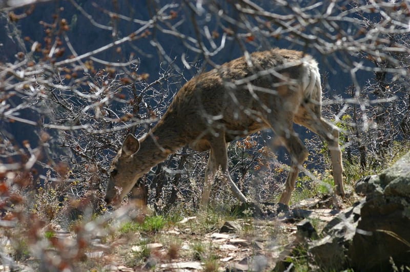
Junipers, pines, shrubs, and grasses grow on the plateau and along the canyon rim. Important riverside habitats survive along the water. Wildlife includes deer, black bears, small mammals, and numerous bird species.
Birds of prey can sometimes be seen soaring above the cliffs on rising air currents. Observe wildlife from a distance, secure food properly, and never approach wild animals.
Best Time to Visit
Late spring through early autumn is generally the most convenient period for visiting the South Rim. During warmer months, the main roads, overlooks, and most popular walking routes are accessible. Autumn brings cooler weather, while some roads may remain closed in spring.
In winter, access along parts of South Rim Drive is restricted depending on snow and road conditions. The North Rim is generally closed to vehicles during winter. Check official updates before traveling.
How to Get to Black Canyon of the Gunnison
The easiest access to the South Rim is from Montrose, Colorado. From US Highway 50, follow CO Highway 347 north. The visitor center is approximately 24 kilometers from Montrose.
The North Rim is reached from Crawford via CO 92 and Black Canyon Road. The final section is unpaved. There is no bridge or direct road connecting the two rims across the canyon, so driving between them on outside roads takes about two to three hours.
Practical Tips for Visitors
Check road and trail conditions before your visit. Bring water, a hat, sun protection, and sturdy footwear. Mobile service is unreliable in the park, so download maps and useful information in advance.
Some canyon edges have no guardrails. Stay away from drop-offs, never throw objects into the canyon, and supervise children closely. Black Canyon of the Gunnison is memorable for its ancient geology, sheer cliffs, and powerful river that continues to shape the landscape.
Gallery