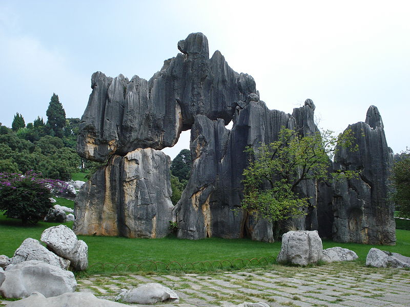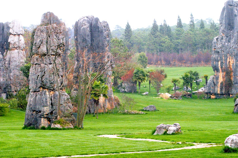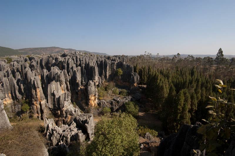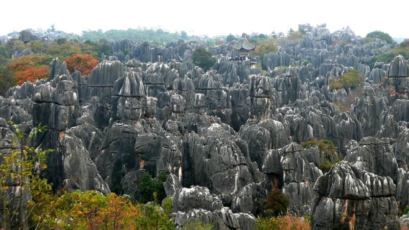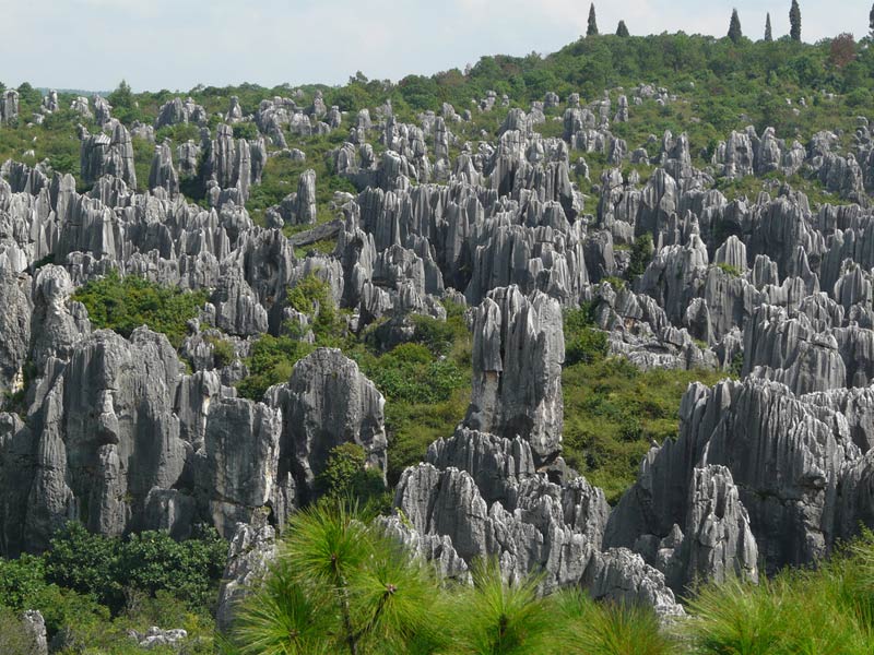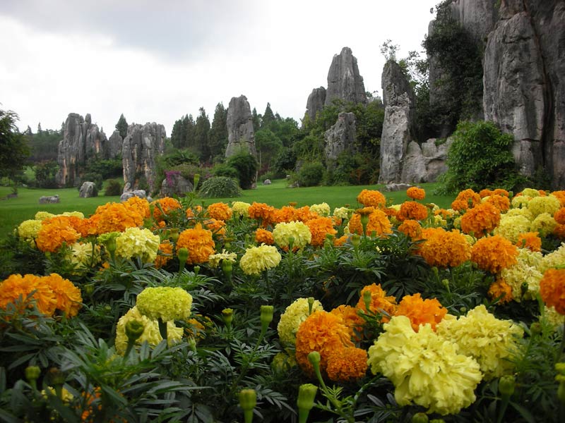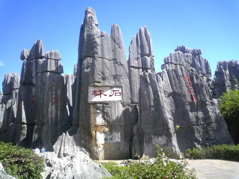

Shilin, also known as the Stone Forest, is an extraordinary natural landscape in Yunnan Province in southwestern China. Thousands of limestone formations rise from the ground like towers, blades, trees, animals, and fantastic structures. Narrow passages wind between the rocks, while the tall stone pinnacles create the impression of a dense forest made of stone rather than wood.
The scenic area lies southeast of Kunming and is one of Yunnan’s best-known attractions. Shilin is valued not only for its unusual scenery but also for its geological significance and the cultural heritage of the Sani people, a community belonging to the Yi ethnic group.
How the Stone Forest formed
The geological history of Shilin began long before humans appeared. Millions of years ago, this region lay beneath an ancient sea where carbonate sediments accumulated. Over time, these deposits became limestone and dolomite. Later, movements of the Earth’s crust lifted the rocks and the sea receded, exposing the formations.
Karst processes played the main role in shaping the landscape. Rainwater and groundwater slowly dissolved the carbonate rock, entered cracks, and widened them. Wind, temperature changes, and other forms of weathering further altered the stone. Over long periods, weaker sections eroded more quickly, leaving resistant rock as tall pillars and jagged ridges.
The region’s geological history spans hundreds of millions of years. Uplift, erosion, and dissolution created a complex landscape of towers, sharp ridges, stone walls, and hollows. Shilin is therefore important to geologists as well as visitors.
The Major Stone Forest
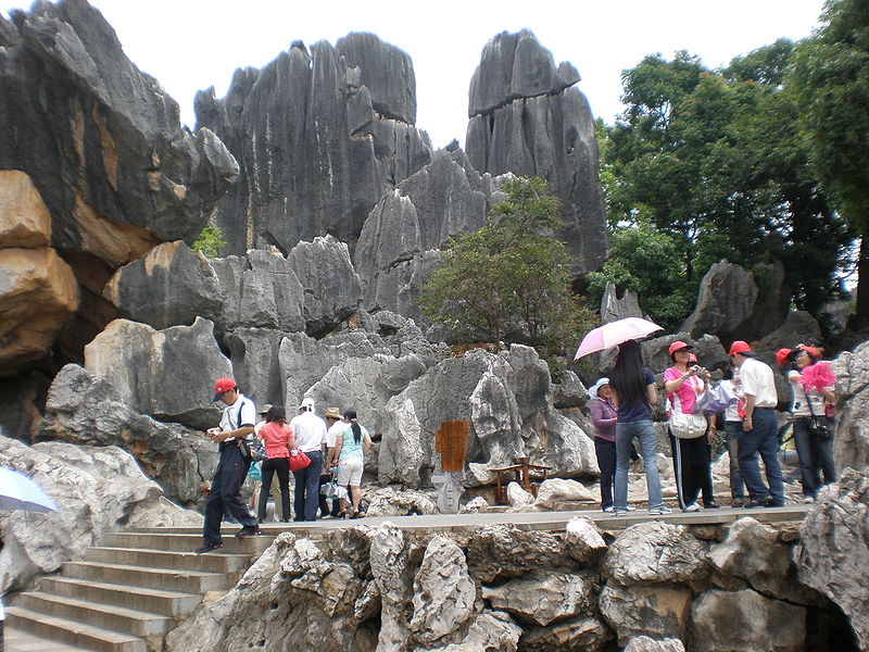
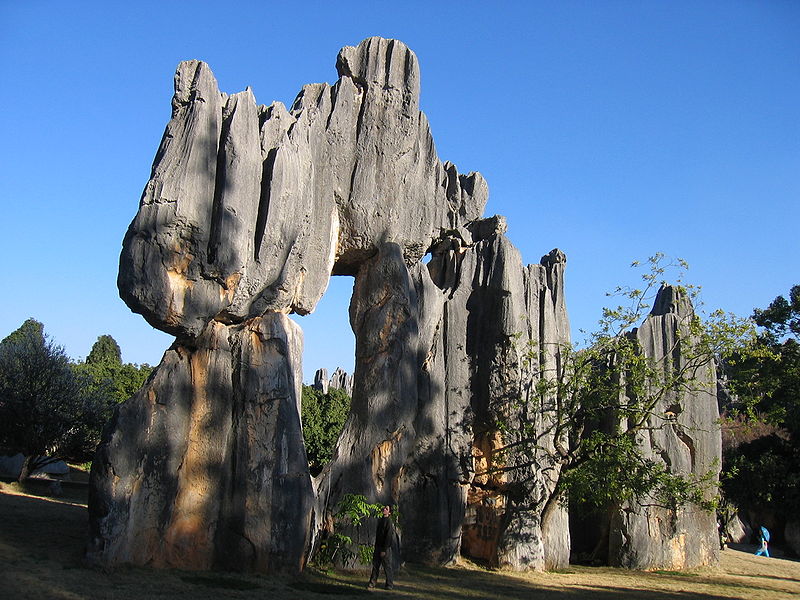
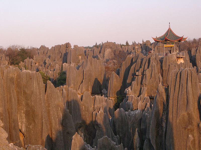
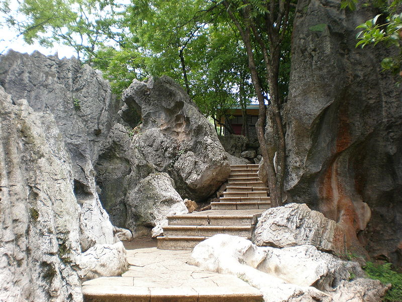
The Major Stone Forest is the best-known part of Shilin. Its rock formations stand close together and in places rise several dozen metres. Their vertical shapes resemble columns, swords, and frozen waves. Walking paths pass between the stone walls, allowing visitors to examine the formations at close range.
The shapes change with the viewing angle. One outcrop may resemble a person, another a bird, an animal, or a castle tower. Many formations have local names inspired by legends and popular imagination. These names add interest to a walk, although the resemblance is ultimately a matter of interpretation.
The stone pinnacles are particularly striking in angled sunlight, when deep shadows reveal their texture. After rain, the limestone can appear more richly toned, while surrounding greenery contrasts with the pale and grey rocks.
The Minor Stone Forest
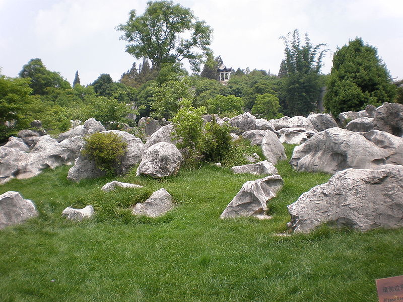
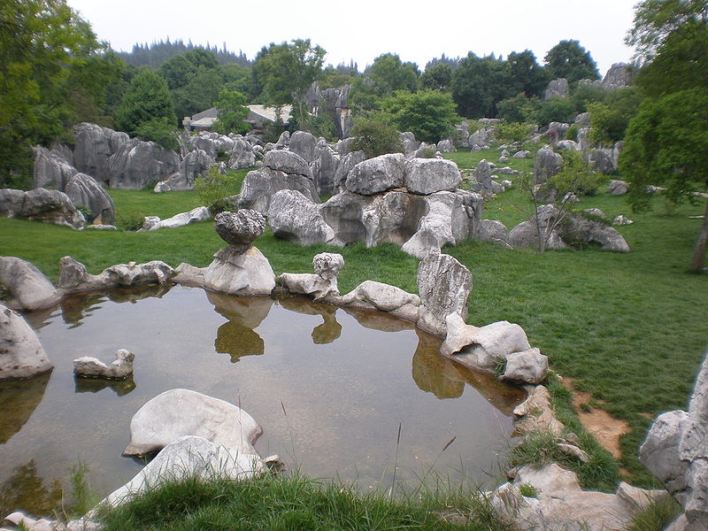
The Minor Stone Forest has a more intimate atmosphere, with winding paths between smaller rock formations. Visitors can see compact stone towers, narrow fissures, and unusual shapes associated with local stories. Vegetation in some areas softens the severe appearance of the limestone walls.
This area is ideal for observing details such as cracks, grooves, hollows, and marks left by long-term water erosion. Even small formations show the variety of karst landforms. The narrow paths also reveal how the rocks create natural stone labyrinths.
The Naigu Stone Forest
Naigu, often translated as the Black Stone Forest, lies in the northern part of the geopark. Unlike the lighter formations in the main scenic area, Naigu features dark-coloured dolomite. The colour of the rock, the shape of the ridges, and the more rugged scenery give it a distinct character.
Naigu is among the important sites within the South China Karst region, which was inscribed on the UNESCO World Heritage List in 2007. Its geology allows visitors and researchers to compare different kinds of stone forest and observe how rock composition influences the landscape.
Lakes, caves, and other natural features
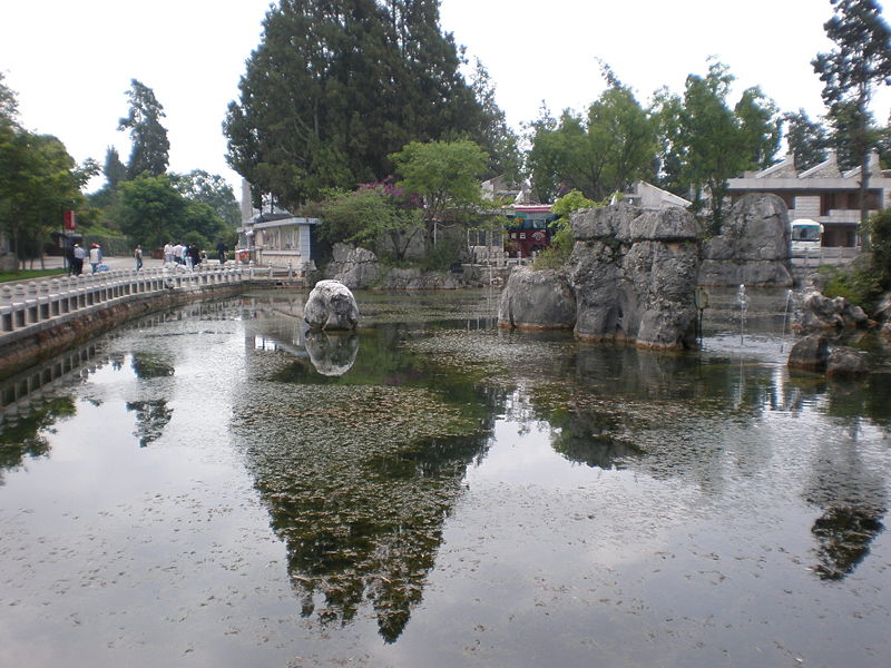
Shilin is more than a collection of rocks. The wider geopark contains karst lakes, caves, valleys, and other distinctive landforms. Changhu Lake is surrounded by green hills and is considered one of the region’s scenic spots. Its calm water provides a contrast to the sharp outlines of the surrounding mountains.
The geopark also includes cave formations and areas where water continues to reshape limestone. Underground cavities, fissures, and water channels develop gradually, sometimes remaining hidden below the surface. Access to individual features depends on the route and visitor regulations.
Legends about the stone formations
Many local legends are associated with the Stone Forest. One story tells of a giant who wanted to build a dam and borrowed magical tools for the task. The tools disappeared when the sun rose, so the giant could not finish the dam, leaving huge stones scattered across the land.
The story of Ashima holds a special place in the cultural traditions of the region’s Sani people, one of the groups within the Yi ethnic community. In the legend, Ashima faces trials involving love, freedom, and injustice. The tale has become an important part of local cultural identity, and some rock formations are interpreted through the characters and events of traditional stories.
The Sani people and the Torch Festival
The Sani people have lived in the Shilin region for generations. Their cultural traditions include songs, dances, embroidery, language, folk stories, and ceremonial celebrations. The close relationship between the landscape and local traditions makes Shilin both a geological landmark and a cultural place.
One of the region’s best-known events is the traditional Torch Festival, held according to the lunar calendar. Celebrations can include torches, music, dance, and folk competitions. Dates change each year in the Gregorian calendar, so visitors should check the schedule before travelling.
Shilin and UNESCO World Heritage
In 2007, the karst landscapes of South China were added to the UNESCO World Heritage List. Shilin is one of the most famous areas within this natural region. Its importance comes from the diversity of its karst formations and the opportunity to observe different stages in the development of limestone landscapes.
Shilin is also part of the UNESCO Global Geoparks network. The geopark combines the protection of natural sites with geological research, environmental education, and support for local cultural traditions.
When to visit Shilin
Kunming and its surroundings are known for a relatively mild climate. Spring and autumn are generally comfortable for walking through exposed areas, while greenery after rainfall creates a vivid contrast with the stone. Summer landscapes can be especially lush, but rain, humidity, and slippery paths are possible.
Early morning and late afternoon are often best for photography, as angled sunlight highlights the relief and creates strong shadows. Popular areas may be busy on weekends and public holidays, so an early start can make the visit more peaceful.
Getting there and practical advice
Shilin is in Yunnan Province, southeast of Kunming. Visitors can reach the area by car, tourist bus, or public transport with transfers, depending on the chosen route. Travel time varies with the departure point, traffic, and park entrance.
Allow several hours to explore the main areas; a full day may be needed for a broader visit to the geopark. Paths sometimes pass between high rocks and include steps and uneven surfaces. Comfortable shoes, drinking water, and sun protection are recommended.
Before travelling, check current opening hours, ticket prices, access to individual zones, and transport schedules. Names of some areas may vary across translations and travel guides, so marking the intended locations on a map in advance can be helpful.
Why visit Shilin
Shilin combines striking scenery, scientific value, and living cultural traditions. Its stone towers show how water and time can transform ancient marine deposits into a complex landscape. Lakes, caves, and the dark formations of Naigu add variety, while the legend of Ashima and Sani traditions give the region a distinctive cultural character.
Gallery