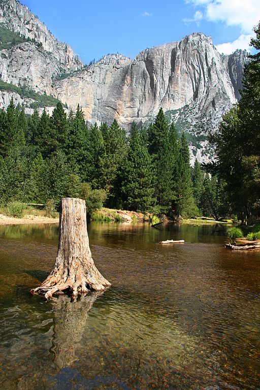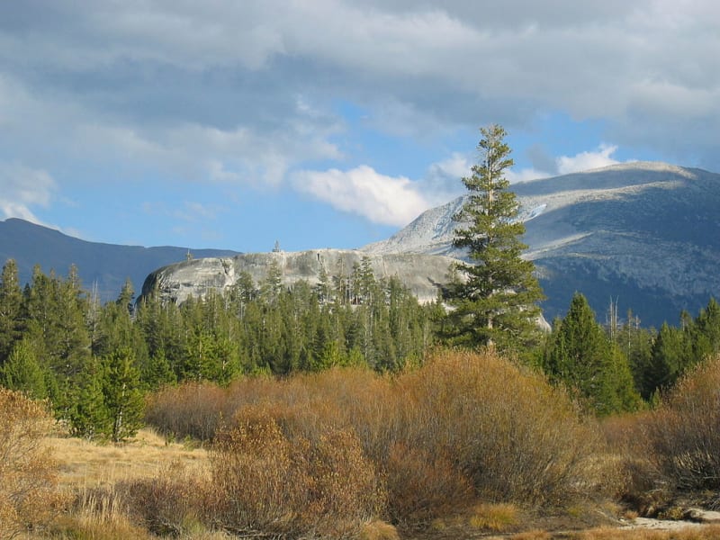

Yosemite National Park is one of the best-known natural parks in the United States, located in the Sierra Nevada mountains of central California. It is famous for towering granite cliffs, high waterfalls, clear rivers, alpine meadows, and ancient giant sequoias. Visitors can explore unusual rock formations, deep glacial valleys, mountain lakes, and extensive forests inhabited by bears, deer, coyotes, and many bird species.
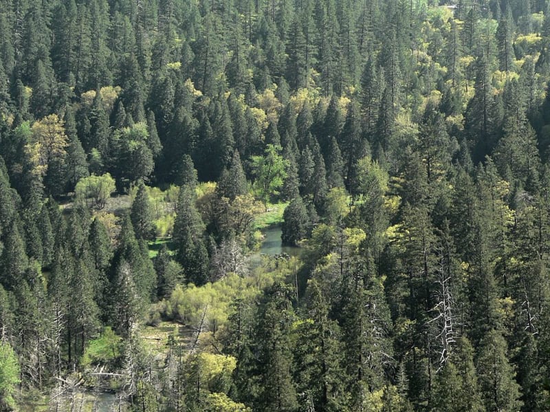
The park covers approximately 3,029 square kilometers. Elevations range from about 600 meters to nearly 4,000 meters above sea level, creating a wide variety of natural environments. Oaks and conifers grow at lower elevations, while higher areas contain mountain forests, subalpine meadows, and rocky alpine terrain. Nearly 95 percent of Yosemite is designated wilderness, where natural ecosystems are protected.
In 1984, Yosemite was designated a UNESCO World Heritage Site. Its landscapes became a symbol of American conservation and inspired explorers, artists, photographers, and travelers. Visitors can choose short walks to famous viewpoints or embark on multiday hikes through remote mountain areas.
Yosemite Valley – the heart of the park
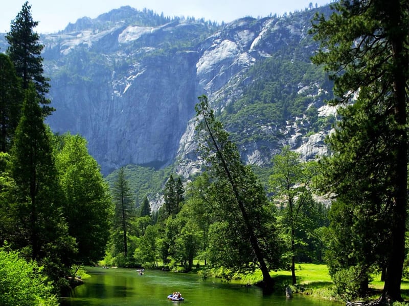
Yosemite Valley is the park’s central attraction and the location of many of its most famous views. It stretches for approximately 11 kilometers and is surrounded by nearly vertical granite walls rising above the Merced River. Towering cliffs, green meadows, forests, and waterfalls create a landscape that attracts millions of visitors each year.
The valley formed through a combination of geological processes. Rivers and the erosion of rock initially shaped the terrain, while later glaciers widened and deepened the valley, creating its characteristic U-shaped profile. As the ice retreated, it left steep walls, polished rock surfaces, and a broad valley floor.
One of the best places to appreciate the panorama is Tunnel View. From here, visitors can see the valley, El Capitan, Half Dome, and Bridalveil Fall. The scenery is especially striking in spring, when waterfalls are flowing strongly and the slopes are covered in fresh greenery.
Walking and cycling routes cross the valley, which also has visitor centers, campgrounds, and picnic areas. It is easy to spend a full day here, combining riverside walks with visits to scenic overlooks. Traffic can be heavy during peak season, so it is worth planning parking and transportation in advance.
El Capitan – the famous granite wall
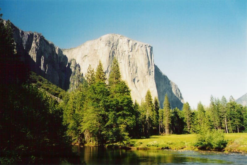
El Capitan is a massive granite cliff rising approximately 900 meters above the valley floor. Its nearly vertical face has become one of the world’s most famous rock-climbing destinations. For decades, climbers have traveled here to attempt demanding routes up its smooth granite walls.
The cliff is remarkable for its immense scale and relatively continuous vertical surface. Even from a distance, visitors can see cracks, ledges, and climbing routes. Watching tiny climbers move across the enormous wall is one of the most memorable experiences for many people visiting Yosemite.
El Capitan is also popular with photographers. Morning and evening light changes the color of the granite and emphasizes its texture. One of the best-known views is from the opposite side of the valley, where the full scale of the cliff becomes apparent.
The name El Capitan comes from a Spanish expression meaning “the captain.” Visitors should follow safety rules near the base of the cliff and on nearby trails, avoid hazardous areas, and obey park guidance.
Half Dome – a symbol of Yosemite
Half Dome is one of Yosemite’s most recognizable peaks. Its rounded granite form appears to have been cut in half, giving the mountain its name. The summit rises to approximately 2,694 meters above sea level and can be seen from various points throughout the valley.
Half Dome developed through geological processes associated with granite formation, mountain uplift, glaciation, and erosion. Its smooth surfaces and steep slopes create a distinctive silhouette that has become one of the symbols of the national park.
Experienced hikers can attempt a demanding route to the summit. It requires good physical fitness, plenty of time, and careful attention to weather conditions. Metal cables assist hikers on the final steep rock section. When the cables are installed and open, a permit is required, with permits distributed through a lottery system.
Hiking Half Dome is not an ordinary walk. The route is long, elevation changes are substantial, and rain, thunderstorms, or wet granite can make the ascent dangerous. Visitors who do not plan to climb the summit can choose viewpoints and shorter trails with views of the mountain.
Yosemite Falls – one of North America’s tallest waterfalls
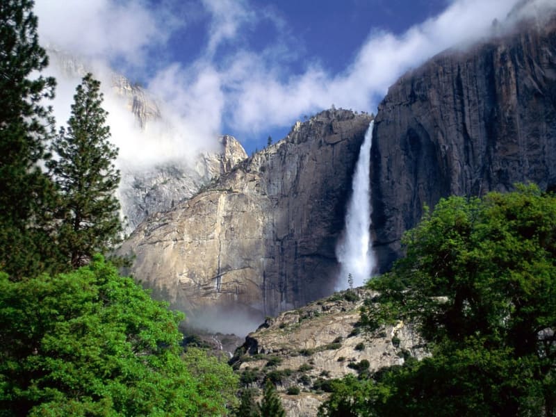
Yosemite Falls is one of the park’s main natural attractions. Its total height is approximately 739 meters, making it one of the tallest waterfalls in North America. It consists of three sections: Upper Yosemite Fall, the Middle Cascades, and Lower Yosemite Fall.
The upper waterfall drops from a high granite wall, after which the water passes over a series of steep cascades before reaching the lower valley. In spring, snowmelt makes the flow especially powerful. The sound of the water can be heard from far away, and rainbows sometimes appear in the spray on sunny days.
During summer, the waterfall often weakens considerably, and in dry years its flow may nearly disappear by the end of the season. Spring and early summer are therefore often the best times to see the strongest flow, although conditions depend on snowpack and rainfall.
A popular short trail leads to Lower Yosemite Fall and is suitable for many visitors. The more demanding trail to the upper waterfall requires considerably more effort and time. Care is needed on wet rocks and steep sections.
Bridalveil Fall
Bridalveil Fall is another famous waterfall in Yosemite Valley. Its name refers to a bridal veil: when the wind catches the water, it spreads into fine droplets resembling a light veil. The waterfall is approximately 188 meters high.
Water drops from a granite ledge and often creates a cloud of mist. The waterfall is especially impressive in spring, when snowmelt feeds its flow. In sunny weather, the spray may produce small rainbows, while the surrounding cliffs emphasize the height and power of the cascade.
The waterfall lies near the entrance to the valley from Tunnel View, making it easy to include in a first visit. A relatively short walk leads to the viewing area, although trail conditions may change because of maintenance, moisture, or seasonal restrictions.
Do not approach slippery rocks beside the water or cross barriers for a closer photograph. Yosemite’s waterfalls are beautiful, but nearby areas can be dangerous because of strong currents, wet surfaces, and falling rocks.
Vernal Fall and Nevada Fall
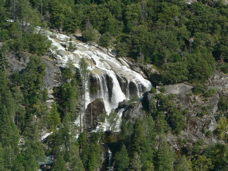
Vernal Fall and Nevada Fall are two impressive waterfalls on the Merced River upstream from the valley. They are among the park’s most popular destinations for hikers. Vernal Fall drops approximately 97 meters, while Nevada Fall is about 181 meters high.
Trails to the waterfalls pass through forests, follow the river, and climb granite steps. One famous route is the Mist Trail. When water flow is strong, spray can cover parts of the path, so appropriate clothing and footwear are important. The rocks can become extremely slippery.
Continuing above Vernal Fall leads to Nevada Fall, where the river plunges down steep granite slopes. The hike requires good fitness, especially for visitors planning to see both waterfalls in one day. Check the route length, elevation gain, and trail access in advance.
The waterfalls are usually most powerful in spring and early summer. Their flow may decrease toward the end of summer, but the surrounding cliffs, forest, and mountain-river scenery remain attractive throughout the season.
Glacier Point – views of the mountains and valley
Glacier Point is one of Yosemite’s best-known viewpoints. Located high above the valley, it offers broad views of Half Dome, Yosemite Falls, forests, and the mountain ranges of the Sierra Nevada. From here, visitors can appreciate the scale of the glacial landscape and the steep granite walls.
On clear days, many details of the valley are visible, including the winding Merced River and individual rocky peaks. The light changes throughout the day, making morning and evening suitable for different types of photography. At sunset, granite walls often take on warm colors.
Access to Glacier Point depends on the season. The road usually closes in winter because of snow and reopens after clearing, with dates varying according to weather conditions. Before traveling, check the official park website for current road information.
Visitors who do not travel to Glacier Point can find other viewpoints and trails in the valley. However, this overlook provides a particularly clear perspective on Yosemite’s scale and the way glaciers shaped the surrounding terrain.
Mariposa Grove – a kingdom of giant sequoias
Mariposa Grove is the largest grove of giant sequoias in Yosemite National Park. It contains about 500 mature trees, some of which can live for several thousand years. Giant sequoias are notable not only for their height but also for their enormous trunks, thick bark, and resilience to certain natural disturbances.
One of the grove’s best-known trees is the Grizzly Giant. Its age is estimated at around 3,000 years, although such estimates have a margin of uncertainty. Standing among trees that were already growing long before modern cities and states existed gives visitors a sense of geological time.
Giant sequoias are adapted to natural forest fires. Their thick bark helps protect the trunks from heat, while fire clears forest litter and creates conditions that support seed germination. Completely excluding fire from the ecosystem can therefore disrupt natural processes in sequoia groves.
To protect roots and soil, visitors should remain on designated trails and avoid walking around the base of the trees. Access and parking arrangements may vary by season. Check current information about shuttles, open trails, and restrictions before visiting.
Tuolumne Meadows and the high country
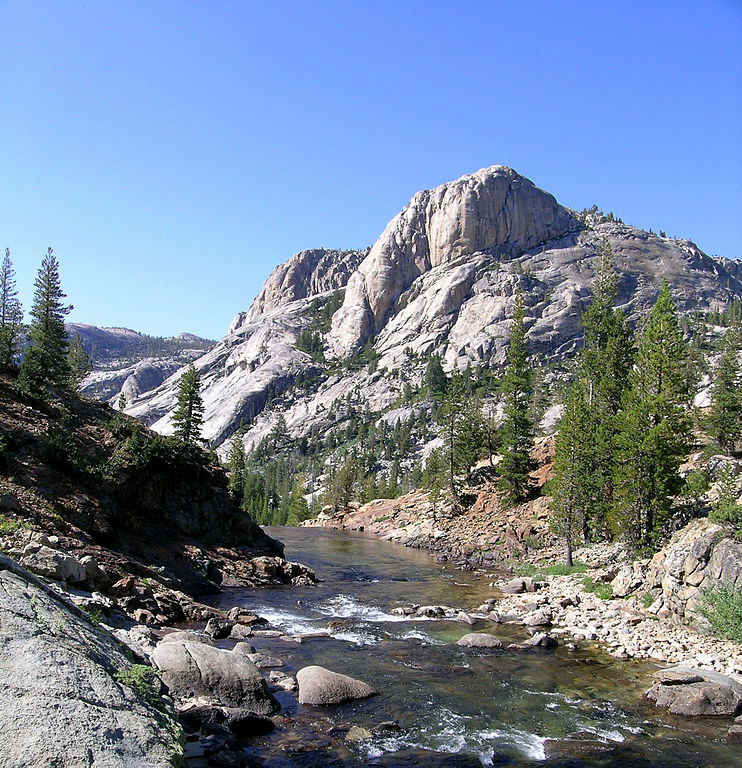
Tuolumne Meadows lies in Yosemite’s high country and differs from the better-known valley through its broad open spaces, winding river, and surrounding granite peaks. It is an excellent choice for visitors seeking a quieter, more expansive side of the park away from the busiest viewpoints.
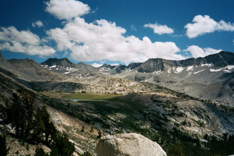
The high-country meadows are especially beautiful in summer, when flowers appear after the snow melts and the river winds between green patches and rocky slopes. Visitors can see mountain lakes, granite domes, and peaks characteristic of the Sierra Nevada. The alpine environment is sensitive to trampling, so it is important to stay on marked trails.
Because of the elevation, the visiting season is shorter than in Yosemite Valley. Snow may remain into summer, and Tioga Road usually closes during winter. Opening and closing dates change each year according to snowpack and weather conditions.
Trails of varying difficulty begin in this area, including multiday routes through the high country. Before setting out, consider the distance, elevation gain, water availability, and possibility of sudden weather changes.
Hetch Hetchy – a lesser-known part of the park
Hetch Hetchy Valley lies in the northwestern part of Yosemite. Granite walls, forests, and waterfalls surround its reservoir, which plays an important role in supplying water to the San Francisco Bay Area. The valley resembles Yosemite Valley in some natural features, although its development history and present use are different.
Visitors can walk along trails beside the reservoir and see waterfalls fed by seasonal rainfall and snowmelt. Compared with the central valley, this area generally receives fewer visitors and can offer a quieter experience.
Hetch Hetchy’s history is tied to long-running debates about conservation and water resources. Construction of O’Shaughnessy Dam in the early twentieth century flooded much of the valley and became a well-known example of the conflict between preserving natural landscapes and meeting urban water needs.
Visitors should follow local access rules and restrictions. Water levels, trail conditions, and access to certain areas can vary with the season and reservoir operations.
Wildlife in Yosemite
Yosemite supports hundreds of vertebrate species, including mammals, birds, reptiles, amphibians, and fish. Some of the most noticeable animals are American black bears, mule deer, coyotes, bobcats, foxes, marmots, and various birds of prey. Many animals avoid people, so observing them requires patience and attention.
Despite its name, the American black bear can have black, brown, or lighter-colored fur. Bears locate food by smell, so unattended food or groceries left in a vehicle can attract them. The park has strict rules for storing food and waste, and visitors must follow them.
Deer are often seen in open meadows and near forest edges. Animals may be more active around dawn and evening, but they must always be observed from a safe distance. Never feed wildlife, approach young animals, or try to attract animals for a photograph.
The park’s range of elevations and habitats supports many bird and animal species. High-elevation areas contain species adapted to cold conditions, while lower areas are home to animals that prefer warmer forests and shrublands.
Geology: how glaciers shaped the landscape
Yosemite’s famous landforms are closely connected to granite and glacial erosion. Granite formed deep within the Earth’s crust and was later exposed by mountain uplift and long-term erosion. Glaciers widened valleys, smoothed some rock surfaces, and left steep walls and rounded domes.
These processes created Yosemite’s distinctive features, including El Capitan, Half Dome, numerous granite peaks, and the broad valley. The landscape continues to change today. Rockfalls, weathering, temperature changes, and water gradually break down even very strong rock formations.
The park’s geology is important not only for understanding its beauty but also for visitor safety. Rockfalls can occur with little warning, so visitors should not linger beneath steep walls, ignore barriers, or leave trails in hazardous areas.
The history of Yosemite conservation
Yosemite holds a special place in the development of the American conservation movement. In 1864, President Abraham Lincoln signed legislation protecting Yosemite Valley and Mariposa Grove under California state stewardship for public use and recreation. This was one of the earliest important examples of government protection for a scenic natural area.
Yosemite National Park was established in 1890, covering a wider area of mountains and forests. Yosemite Valley and Mariposa Grove later became part of the federal park as well. Naturalist John Muir played a major role in advancing conservation ideas and advocating for the protection of the Sierra Nevada’s mountain landscapes and forests.
Today, the park protects natural and cultural resources while welcoming large numbers of visitors. Management requires a balance between public access, vulnerable ecosystems, fire prevention, and preservation of historic sites.
When to visit Yosemite
Spring is one of the best seasons for seeing waterfalls. Snowmelt fills rivers and makes the water flows especially powerful. Plants begin to bloom in the valley, although the weather can remain cool and changeable.
Summer is suitable for hiking, visiting the high country, and taking longer walks. It is also the busiest season, and some areas may close because of fires, roadwork, or other restrictions. Visitors planning a trip in July or August should arrange lodging and transportation in advance.
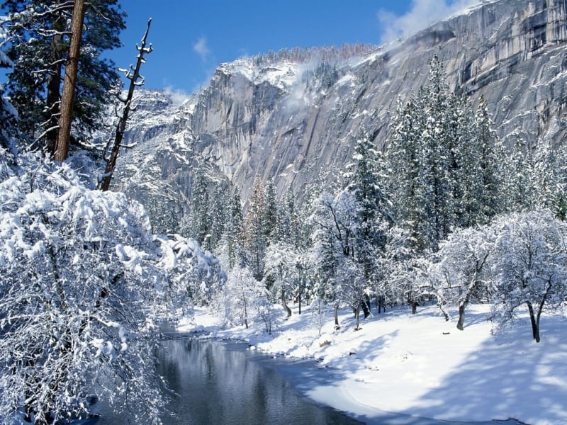
Crowds often decrease in autumn, while lower elevations may still offer pleasant walking weather. Waterfall flows usually weaken toward the end of the dry season. Winter can bring snow and ice to the valley, while high-country roads close. At the same time, winter Yosemite attracts visitors with quiet scenery and snow-covered granite cliffs.
Routes and trip planning
First-time visitors often choose Yosemite Valley, Tunnel View, Yosemite Falls, Bridalveil Fall, and viewpoints overlooking El Capitan and Half Dome. This route offers the park’s signature scenery without requiring demanding multiday hikes.
If you have several days, consider adding Glacier Point, Mariposa Grove, and Tuolumne Meadows. Distances should be taken seriously: mountain roads are winding, and driving between areas may take much longer than a map suggests. Access to some roads and trails depends on the season.
The park has campgrounds, hotels, picnic areas, visitor centers, and bus services in certain areas. Lodging and campsites should be reserved well in advance for popular dates. Downloading offline maps is useful because mobile service is not available everywhere.
Safety and nature conservation
Visitors should take particular care near waterfalls, rivers, and steep rock formations. Rocks beside the water are often slippery, and currents can be strong even where the water appears shallow. Do not cross barriers or swim in areas with dangerous currents.
Before hiking, check the route length, elevation gain, weather forecast, and trail conditions. Carry enough water, suitable footwear, sun protection, and extra warm clothing for high elevations. Weather can change suddenly even during summer.
To protect Yosemite’s natural heritage, do not leave litter, damage plants, collect natural objects, or feed wildlife. Follow food-storage rules, stay on marked trails, and respect the natural environment. Yosemite’s dramatic cliffs, powerful waterfalls, and ancient trees all require careful stewardship.
Yosemite National Park combines monumental granite formations, high waterfalls, ancient sequoias, mountain meadows, and rich wildlife. Its landscape tells the story of glaciers, water, rock, and living organisms interacting over millions of years. This combination of natural beauty, geological significance, and conservation history makes Yosemite one of the most valuable national parks in the United States.
Gallery