
Quebrada de Humahuaca is a long mountain valley in northwestern Argentina, in Jujuy Province. It follows the Río Grande through the dry slopes of the Andes and is known for colourful rock formations, archaeological remains and traditional settlements. Its natural scenery is closely connected with the history of Indigenous communities, trade, farming and cultural traditions that have endured for centuries.
In 2003, Quebrada de Humahuaca was added to the UNESCO World Heritage List as a cultural landscape. Its importance lies not only in its scenery but also in its historic role as a corridor linking the high Andes with lower regions of South America for thousands of years.
Geography and natural features
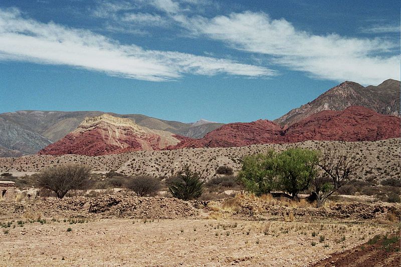
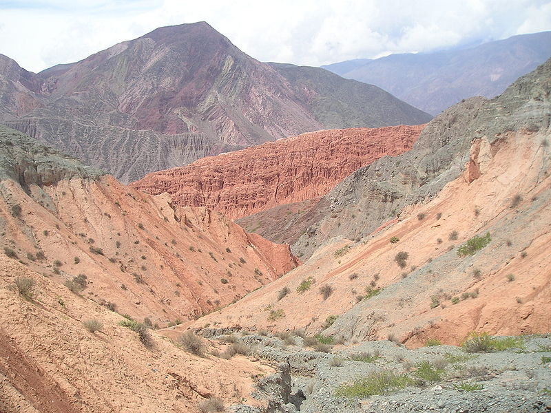
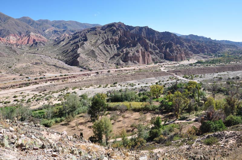
The valley lies in northwestern Argentina, near the borders with Bolivia and Chile, and extends for about 155 kilometres. The Río Grande has shaped much of its landscape, while mountain ranges rise on either side. The rocks display a striking range of colours and complex geological structures.
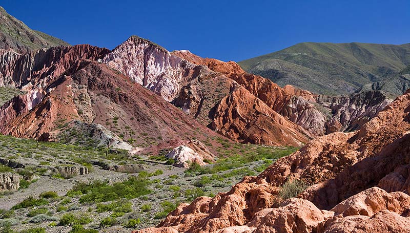
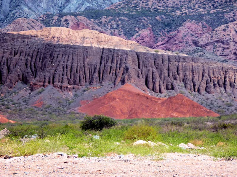
Red, ochre, yellow, grey, green and purple tones appear across the slopes. They result from geological processes, mineral deposits and long periods of erosion. Wind, water and temperature changes have gradually formed cliffs, ravines and unusual rock shapes.
The climate is generally dry, with many sunny days. Rainfall is uneven, and temperatures can change considerably between day and night. The sun can be intense at this elevation, so visitors should use sun protection and drink plenty of water.
A history spanning ten thousand years
Quebrada de Humahuaca served as an important route long before modern roads existed. Archaeological evidence indicates that people used the area from around 9000 BC. Early hunter-gatherer communities travelled through the valley, sheltered in mountain caves and made use of local resources.
Over time, some communities adopted farming and settled lifestyles. Villages developed alongside crafts and trading networks. The valley connected the high Andes with warmer lowlands, allowing people, food, raw materials and goods to move between regions. Caravan trade became an important part of local economies.
In the centuries before the Spanish conquest, fortified settlements known as pucaras were built on elevated sites. Their positions offered views over the surrounding land and helped control important routes. Remains of stone houses, defensive structures and agricultural terraces reveal how communities organised themselves and adapted to mountain conditions.
In the 15th century, the region came under the influence of the Inca Empire and became part of a wider Andean network of roads and exchange. Spanish forces arrived in the 16th century, bringing new settlements, churches and administrative centres. Local traditions did not disappear entirely; they continued to evolve alongside introduced customs.
During the 19th century, the valley was connected with the struggles for independence in South America. Its strategic location made it important for the movement of people and troops. Today, the region preserves traces of several historical periods, from prehistoric sites to colonial architecture.
Why UNESCO recognises the valley
The valley's main value lies in the combination of natural scenery and cultural heritage. Archaeological sites, historic settlements, religious buildings, traditional farming systems and sections of ancient roads survive within the region. Together, they show how the valley supported travel, trade, agriculture and cultural exchange over thousands of years.
Quebrada de Humahuaca is not a static open-air museum but a living cultural landscape. Local communities continue to maintain crafts, festivals, music, oral traditions and distinctive architecture. Modern life remains closely connected to the heritage of earlier generations.
World Heritage status highlights the need to protect archaeological remains and historic buildings. Tourism, construction and changes in traditional land use require careful planning to preserve the relationship between the natural environment and local culture.
Colourful mountains and unusual rock formations
The valley is famous for its colourful mountain scenery. Layers of sedimentary rock appear in red, orange, yellow and grey, creating patterns that resemble stripes, waves and geological cross-sections. In some places, the slopes look as though they have been painted by hand.
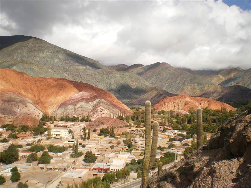
One of the best-known natural landmarks is Cerro de los Siete Colores, or the Hill of Seven Colours, near the village of Purmamarca. Its slopes contain layers of rock formed during different geological periods. The colours are particularly vivid in soft morning light, when the contours and layers stand out clearly.
Another recognised formation is Cerro de los Ocho Colores, or the Hill of Eight Colours. The region also contains unusual rock shapes, deep ravines and rugged ridges. Differences in mineral composition and weathering create a changing palette throughout the valley.
Purmamarca and the Hill of Seven Colours
Purmamarca is one of the valley's best-known settlements. This small village lies beneath the Hill of Seven Colours and attracts visitors with its traditional buildings, narrow streets and views of the striped mountains. Local houses, a historic church and a central square reflect the character of everyday life in the settlement.
Markets sell handmade crafts, textiles, woollen goods, pottery and souvenirs decorated with traditional Andean patterns. Craft production remains an important part of the local economy and helps preserve the region's artistic traditions.
Walking routes around Purmamarca offer different views of the colourful mountain and neighbouring ranges. Some trails cross dry, rocky ground, so sturdy footwear is recommended. Certain sections have little shade, making sun protection important.
Tilcara and its ancient pucara
Tilcara is another important settlement, known for the archaeological complex of Pucará de Tilcara. This pre-Columbian fortified settlement stands on a rise above the valley. The remains of stone structures help visitors understand its layout and strategic position.
The archaeological site includes preserved and reconstructed sections, foundations of dwellings, walls and open spaces. It offers insight into how local communities organised daily life, defended their settlements and used the surrounding land. Some structures were reconstructed during the 20th century, so the present appearance does not entirely reflect the original site.
Tilcara is also known for craft workshops, museums and cultural events. It makes a convenient base for exploring the valley, nearby villages and archaeological sites.
Humahuaca and local traditions
The town of Humahuaca lies in the northern part of the valley and gives the region its name. Its historic centre retains traditional architecture and reflects centuries of trade and cultural exchange. The central square, historic buildings and church are among its notable landmarks.
Andean music, folk festivals, crafts and oral storytelling remain part of local culture. Community rituals often combine Indigenous beliefs with Catholic traditions. During festivals, visitors may hear traditional instruments and see colourful costumes.
Carnival is one of the region's important celebrations, featuring music, dancing and community ceremonies. Dates and customs vary according to local tradition. For residents, these events are not simply tourist attractions but an important part of cultural life.
Ancient agricultural terraces
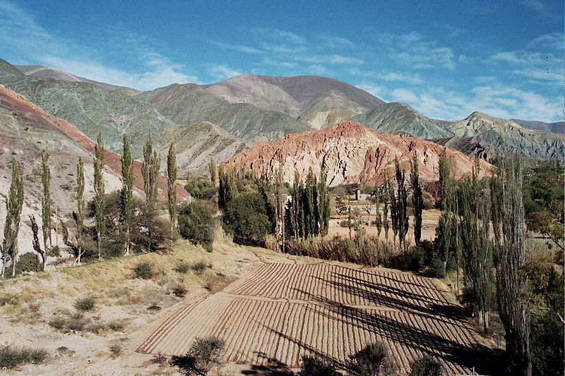
Quebrada de Humahuaca preserves evidence of sophisticated farming in a challenging mountain environment. Terraces were built on slopes to make use of limited cultivable land. Stone retaining walls helped hold the soil and create fields on uneven terrain.
The agricultural terraces around Coctaca are particularly notable. Some are ancient and associated with fortified settlements known as pucaras. Parts of the traditional field systems are still used today, demonstrating the continuity of local farming practices.
The terraces reveal how well earlier communities understood the local climate and terrain. In an area with limited rainfall and major changes in elevation, efficient land use was essential. The combination of engineering, agriculture and settlement is one of the valley's most valuable cultural features.
How to reach Quebrada de Humahuaca
San Salvador de Jujuy, the provincial capital, is a common starting point for trips into the valley. National Route 9 runs north through the region's main settlements, including Purmamarca, Tilcara and Humahuaca.
Visitors can travel by rental car, intercity bus or organised tour. A car offers more freedom to stop at viewpoints and visit smaller villages. Buses are useful for travelling between major settlements, but schedules and service frequency should be checked in advance.
The nearest major airport is near San Salvador de Jujuy. Some travellers arrive through the city of Salta farther south and continue by road. Journey times depend on the route, road conditions and the number of stops.
When to visit
Quebrada de Humahuaca is attractive throughout the year, but many visitors prefer the drier season, when prolonged rainfall is less likely and roads and walking routes are often easier to use. Mountain weather can still change quickly, and daytime and nighttime temperatures may differ considerably.
Morning is often a good time to photograph the colourful mountains because soft light highlights the contours and layers of rock. Midday sunlight can be intense and shadows sharp, while the colours change again in the evening.
Popular villages can become crowded during local festivals and Carnival. These events offer an opportunity to experience regional culture, but accommodation and transport should be planned ahead. Spending several days in the valley allows visitors to explore beyond the best-known viewpoints.
Practical advice for travellers
Because of the elevation, some visitors need time to acclimatise. During the first hours, avoid strenuous activity, walk at a comfortable pace and drink enough water. If significant symptoms of altitude sickness occur, stop ascending and seek medical advice.
Sunlight can be intense in dry mountain areas even when the air feels cool. Sunscreen, a hat and sunglasses are recommended. Closed shoes with good grip are useful on rocky trails, while longer walks require sufficient water and protection from wind.
Before travelling, check opening hours for museums and archaeological sites, road conditions and access to guided routes. Services in smaller villages may operate on limited schedules. Respect local customs, stay on permitted routes at archaeological sites and do not remove stones or other natural and historic objects as souvenirs.
Why visit Quebrada de Humahuaca
Quebrada de Humahuaca combines striking geology, ancient history and the living culture of the Andes. Visitors can see unusually coloured mountains, walk through traditional settlements, explore archaeological sites and learn how people adapted to life in a high-altitude valley over thousands of years.
The region is ideal for travellers interested in landscapes, pre-Columbian civilisations, local crafts and less familiar routes through South America. Its heritage is not limited to ancient ruins: local communities still live here, maintain traditions and shape the valley's contemporary identity.
Gallery